
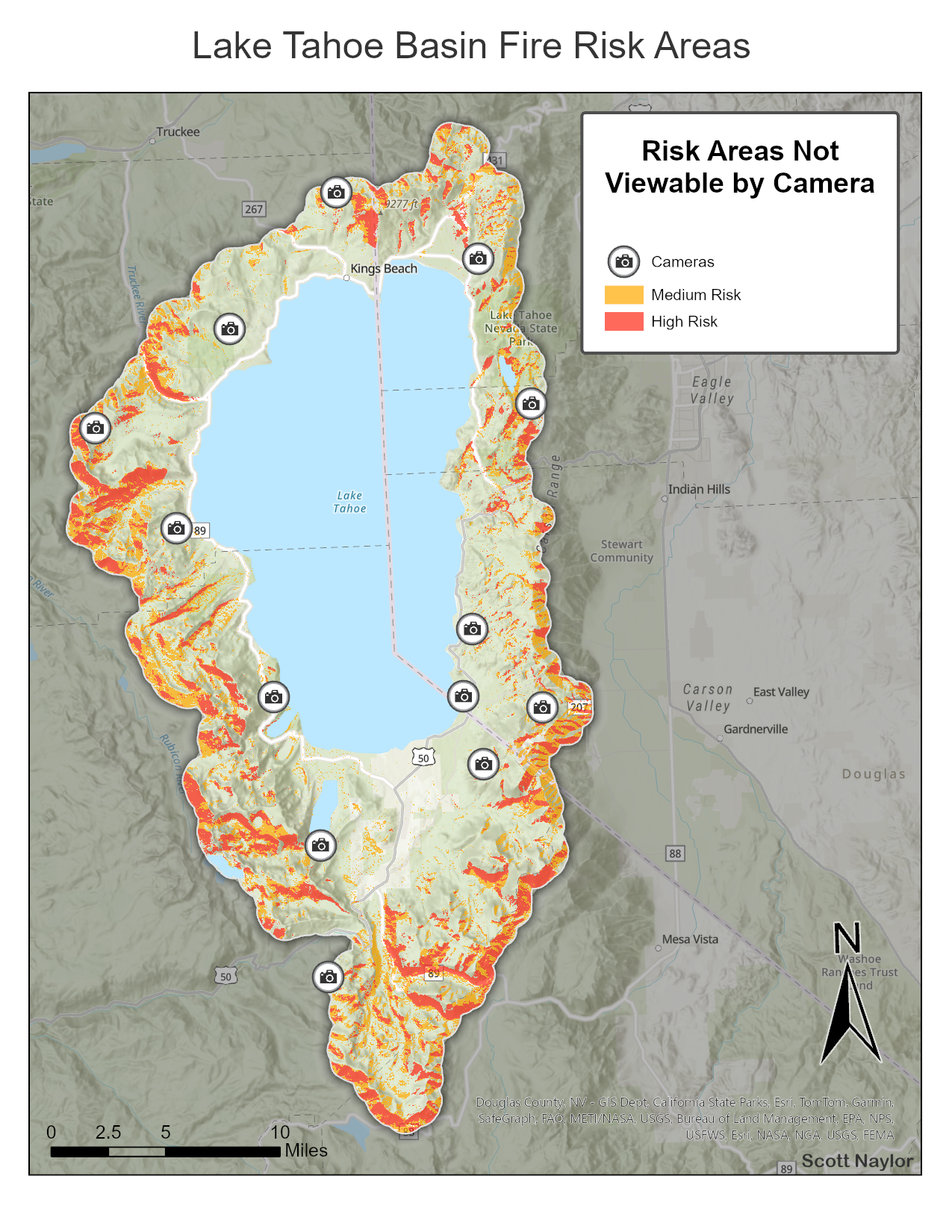
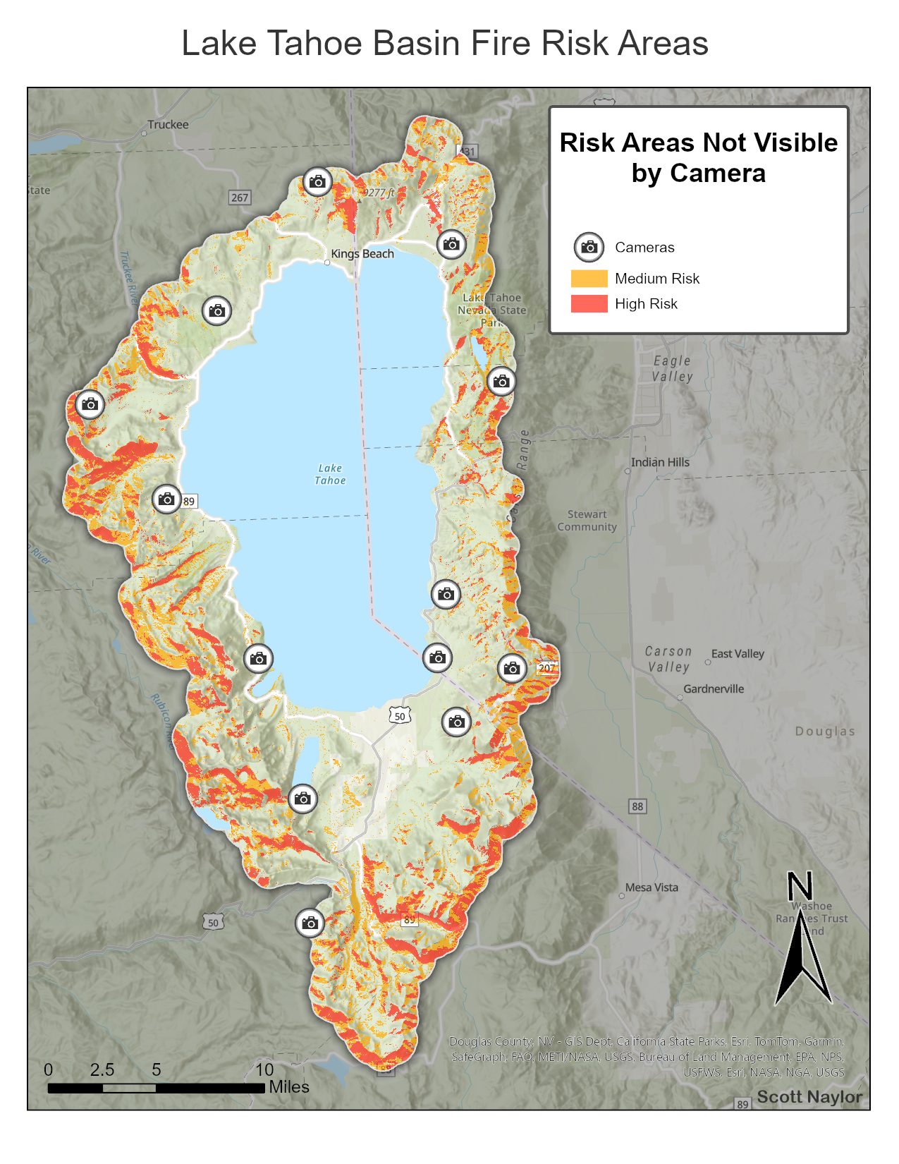
The Lake Tahoe Basin presents a high-risk wildfire environment due to dense vegetation, steep terrain, and extensive development within the wildland–urban interface. Limited evacuation routes and high seasonal population surges increase the potential for significant impacts during a major fire event.
This project models wildfire risk across the basin using terrain and fuels data, and incorporates camera viewshed analysis to evaluate monitoring coverage and identify potential blind spots.
Workflow
- Defined the Lake Tahoe Basin boundary as the study area and clipped all input datasets to this extent
- Compiled elevation (DEM) and vegetation/fuels datasets for the study area
- Derived slope and aspect from elevation data to represent terrain-driven fire behavior factors
- Reclassified terrain and fuels layers into standardized wildfire risk categories based on relative influence
- Combined reclassified layers using raster calculator to generate a composite wildfire risk surface
- Integrated fixed camera locations and performed viewshed analysis using elevation data
- Identified high-risk areas outside of camera visibility to highlight monitoring gaps
- Designed map layout and final output to clearly communicate spatial patterns of wildfire risk and highlight gaps in monitoring coverage
Key Insights
- High-risk areas are concentrated on steep, south- and west-facing slopes where terrain and fuels align to support increased fire intensity and spread
- Several high-risk zones fall outside of existing camera viewsheds, indicating gaps in current monitoring coverage
- Unmonitored high-risk areas are primarily concentrated along the west and south portions of the basin, where terrain limits line-of-sight visibility
- Results demonstrate how integrating terrain, fuels, and visibility analysis can support more effective wildfire detection and response planning
Project Notes
- Viewshed analysis assumes a 360-degree field of view for each camera location
- Camera visibility was constrained using an assumed maximum range of 15 miles to limit viewshed extent
- Terrain was the primary limiting factor in visibility, with obstructions derived from elevation data
- Atmospheric conditions, vegetation occlusion, and camera-specific limitations were not incorporated into the visibility model
- Wildfire risk surface represents a relative index based on terrain and fuels, not a predictive fire behavior model
- Results are intended for conceptual analysis and identification of spatial patterns rather than operational deployment