
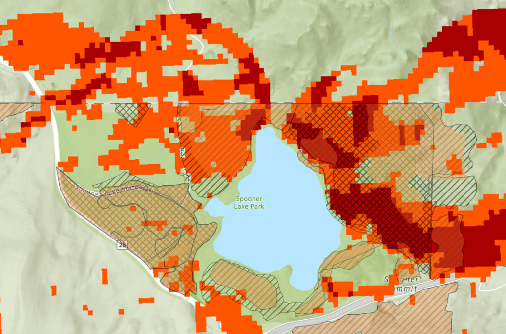
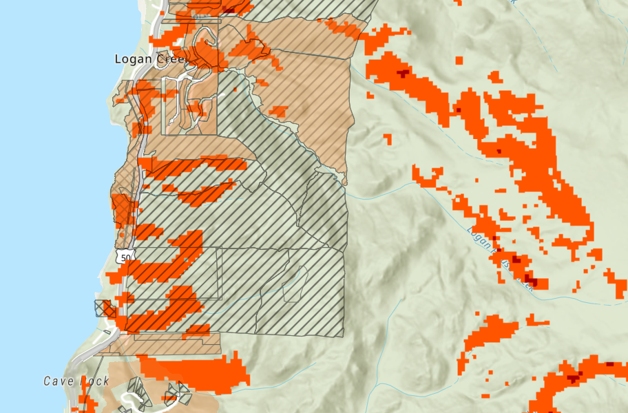
Wildfire risk in the Lake Tahoe Basin is concentrated in the wildland–urban interface, where proximity to development increases both ignition likelihood and potential impact. Fuels management efforts prioritize these areas to create defensible space and reduce fire intensity near communities.
This project models wildfire risk within 500 meters of road networks as a proxy for wildland–urban interface exposure and integrates fuels reduction project data from the Tahoe Resource Conservation District to compare modeled risk with active mitigation efforts.
Workflow Overview
- Acquired and prepared core datasets including multiple digital elevation model (DEM) tiles, land cover, road networks, and fire-related reference data
- Mosaicked DEM tiles to create a continuous elevation surface for the study area
- Clipped and aligned all datasets to a consistent extent and projection to ensure accurate raster analysis
-
Derived terrain variables from DEM:
- Slope to represent potential fire spread rate
- Aspect to identify solar exposure and fuel dryness patterns
-
Reclassified input layers into fire risk categories:
- Land cover grouped by fuel type and burn potential
- Slope and aspect normalized into relative risk classes
- Applied a 500-meter road proximity buffer to represent wildland–urban interface (WUI) exposure and elevated ignition risk
- Combined reclassified layers using Raster Calculator to generate a composite wildfire risk surface
-
Post-processed outputs for visualization:
- Smoothed and symbolized raster outputs
- Converted outputs to vector or styled raster formats for cartographic presentation and web display
Application View
A simplified application view of wildfire risk and fuels treatment data designed for clear visualization and interpretation.
Source Webmap
View underlying layers and data structure.
Project-Specific Notes
- Fire risk analysis constrained to areas within 500 meters of road networks to represent wildland–urban interface (WUI) exposure and proximity to structures
- Reflects real-world fuels management strategy, where treatments prioritize defensible space and buffer zones near developed areas
- Integrated fuels reduction project data from the Tahoe Resource Conservation District to compare modeled risk with active mitigation efforts
- Output configured for webmap and application formats to support interactive exploration and data accessibility